

A' Chaoirnich [Maol Creag an Loch]
Good walks are even better shared.
NN7380 : Maol Creag an Loch
Gerald Davison Photo source
Overview
A' Chaoirnich [Maol Creag an Loch]
Nestled within the stunning Scottish Highlands, A' Chaoirnich can be a delightful day hike that promises both breathtaking views and a smattering of humour along the way. Standing at an elevation of 850 meters, this Munro commands respect and attention.
Geology
A' Chaoirnich is composed primarily of granitic rock, a resilient material that bears the marks of glacial sculpting. Hikers can witness the remnants of past ice ages, with smooth surfaces and rugged cliffs providing a contrast that showcases nature's artwork. Be prepared to marvel at the sheer force that has formed these landscapes!
Route Overview
Starting from the Inverfarigaig Car Park, this route of approximately 12.5 kilometres round trip typically takes around 4.5 hours. The trail winds through stunning heather landscapes and delivers some not-so-distant views of Loch Ness, provided you keep your eyes peeled!
Summit Features
Upon reaching the summit, hikers will find a modest but welcoming cairn, offering a fantastic photo opportunity—and perhaps a moment of reflection or celebration if you’ve packed a snack!
Terrain
Prepare for a mix of rocky patches and grassy moorland, with occasional bogs that seem to have a knack for attracting unsuspecting boots. Sturdy footwear is advisable—you don’t want to spend your day squelching about!
Views
Once at the top, be ready to soak in the views of Ben Nevis to the south-west and Loch Ness shimmering in the distance. The best time for photographs is during late spring or early autumn when the light sets just right, capturing the epic beauty of the Highlands.
Hazards
As with any hike in the Highlands, be cautious of rapidly changing weather. Conditions can turn from sunny optimism to soggy despair in the blink of an eye! Rockier sections can also present a challenge; tread carefully.
Nearby Summits
If you’re feeling ambitious, consider extending your adventure to nearby peaks such as Ben Wyvis or Sgurr na Lapaich, but don’t forget to pace yourself!
Access
Parking at Inverfarigaig is readily available. For those relying on public transport, regular bus services from Inverness will get you close to the village of Foyers, where local taxis can whisk you to the trailhead.
Facilities
While the mountain itself lacks facilities, Foyers offers several cafes and a shop for essential supplies, including a lovely spot to grab a hot drink—an essential for any well-deserved break after your jaunt!
History
The mountain’s name, translating to 'the hill of the hollows', hints at its fascinating topographical features and ties to Scottish folklore, ensuring a connection to history that weaves through the very landscape itself. Who knows? Maybe you’ll encounter a highland legend or two during your hike!
In summary, A' Chaoirnich offers more than just a hike; it serves as a reminder of nature's majesty, history, and perhaps, its playful mysteries. So lace up those boots and embark on an adventure that’s as enriching as it is exhilarating!
Explore routes near A' Chaoirnich [Maol Creag an Loch]
Walks starting near this hill. Open a route to check its map, distance and full itinerary.
Aberfeldy: Glassie Woodland and River Tay Circular
View route
Rothiemurchus: Beaver Trail and Lochan Mor
View route
Aviemore: Loch an Eilein and the Croft Track from Rothiemurchus
View route
Kenmore: Drummond Hill Black Rock Trail above Loch Tay
View route
Route planning notes
These notes describe possible approaches. Check a route's map and access information when planning your walk.
From the Inverfarigaig Car Park
A well-trodden path, with clear markers leading you through heather-clad hillsides before the final ascent to the summit. Perfect for a lovely day out.
Make a day of it, together
Find someone to share the walk with, or organise a day out along a route you like.
Photo Gallery
View all Photo could not load
NN7380 : Maol Creag an Loch
Gerald Davison
 Photo could not load
NN7380 : Maol Creag an Loch
Gerald Davison
 Photo could not load
NN7380 : A' Chaoirnich summit (875m)
Colin Park
 Photo could not load
NN7380 : Maol Creag an Loch
Gerald Davison
 Photo could not load
NN7380 : Small Cairn, Smaller Dog
Adam Ward
Hill facts and local notes
Classifications
Elevation
876m
2,873 ft
Prominence
214m
Coordinates
56.9004, -4.0782
NN735807
OS Map
42
Explorer: OL51W 394W
At the Summit
The summit features a modest cairn, proudly standing as a testament to the many hikers who have conquered this Munro. A welcoming sight at the top, though it won't offer you a cup of tea!
Terrain & Geology
A' Chaoirnich is primarily composed of granitic rock, which is typical of the area. The erosion patterns on the mountainside showcase the power of glacial activity in shaping the landscape, with smooth surfaces juxtaposed against rugged cliffs.
Views & Scenery
On a clear day, look out for towering peaks such as Ben Nevis to the south-west and the shimmering waters of Loch Ness to the north.
History & Heritage
Name Origin
A' Chaoirnich translates to 'the hill of the hollows' in Scots Gaelic, perfectly fitting for its rolling contours.
Historical Significance
The area is steeped in Highland folklore, with tales of faeries and spirits said to roam the moors. Who knows, you may even bump into one on your trek!
Getting There & Facilities
Parking
There is a parking area at Inverfarigaig, which can accommodate several vehicles. Arrive early during weekends to beat the rush!
Public Transport
Regular bus services operate from Inverness to the nearby village of Foyers, with connections to local taxi services to take you to the car park.
Nearby Facilities
While there are no facilities directly at the mountain, the nearby village of Foyers offers some cafés and a shop for last-minute supplies. And don’t forget, a public loo may also be found in Foyers!
Safety Information
Known Hazards
- Beware of sudden weather changes; the Highlands can go from sunny to soggy faster than you can say 'Scottish weather'. Additionally, the rocky terrain requires good footwear to avoid slips.
General Safety Tips
- Check weather conditions before setting out
- Carry appropriate clothing and equipment
- Let someone know your planned route
- Take a map, compass, and GPS device
- Carry emergency supplies: food, water, first aid kit, torch
Hills
Some common questions about the hills answered
Are there group walks up A' Chaoirnich [Maol Creag an Loch]?
Many walkers use Walkmates to join or organise walks with others. You can check for group walks around A' Chaoirnich [Maol Creag an Loch] through the maps
Are there other walkers around A' Chaoirnich [Maol Creag an Loch]?
Activity varies by location and time, but Walkmates lets you see whether others have shared walks or shown interest in this area. Find other people through the walking friends search walking friends for A' Chaoirnich [Maol Creag an Loch] search or of course create your own walk for A' Chaoirnich [Maol Creag an Loch]
Can I organise a walk to A' Chaoirnich [Maol Creag an Loch]?
Yes. If there aren’t any walks listed already, you can create a walk and make it available for others to join.
If you're signed up to Walkmates, you can create a walk to A' Chaoirnich [Maol Creag an Loch].
How do I find a walk up this hill?
There are often multiple ways to walk this hill, depending on experience and route preference. Walkmates helps you explore walks and routes that others have shared.
Can I suggest a new route up A' Chaoirnich [Maol Creag an Loch]?
Yes. You can suggest or create routes to share with others. Walkmates focuses on the social side of walking, so routes are used to help people organise walks and explore areas together, rather than as detailed navigation tools or route libraries.
Other uses really appreciate knowledgeable walkers sharing their routes. Share your favourite route to A' Chaoirnich [Maol Creag an Loch] here
The is an error or something incorrect about this hill. How do I let you know?
We always strive to keep the information on Walkmates as accurate as possible. If you find an error, please let us know through the contact form and we'll aim to correct it as quickly as possible
Community Discussion
Comments
Location
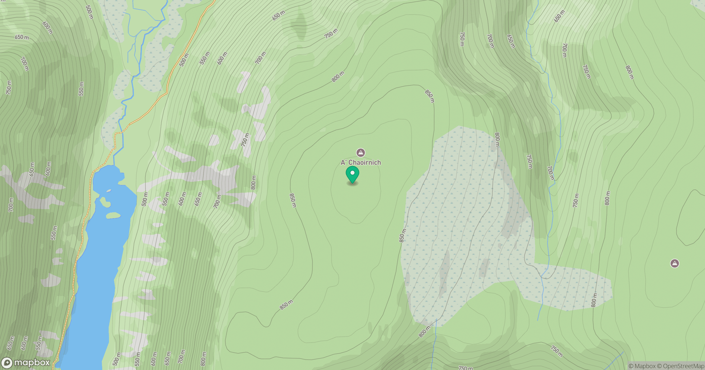
Grid reference: NN735807
View on OpenStreetMapOpens a map in a new tab, centred on the hill.
No comments yet. Be the first.